Pi-MEP Regions
The Pi-MEP considers as 'validation regions' a modified version of the ocean boundaries given in 'The Limits of Oceans and Seas' [IHO Special Publication 23, 1953]. It includes the global ocean, the arctic ocean, the Atlantic ocean (North, South and tropical), the Pacific ocean (North, South and tropical), the Indian Ocean, the South China Sea, the Southern Ocean, the Mediterranean sea, the Bay of Bengal, the Sea of Japan, the Baltic Sea and the Gulf of Mexico.
The Pi-MEP also considers:
- SPURS-1 and SPURS 2 regions which correspond to the locations where 2 international in situ field campaign took place in 2012-2013 and 2016-2017, respectively, with huge availability of in situ salinity measurements.
- The OTT zone corresponding to an area in the South Pacific (far from coast) where a combination of SMOS images and model are used to derived the so-called Ocean Target Transformation (OTT), an important part of the SMOS calibration procedure.
- The SMOS coastal zone (<800km) which corresponds to "coastal" (<800km) areas where it is known to be very challenging to retrieve SSS due to Land-Sea contamination.
- Regions corresponding to the different case studies.
NetCDF files with the mask of each region are provided.
Match-up databases are analyzed globally but also for each Pi-MEP validation region. A dedicated Match-up report is provided for each triplet: Pi-MEP Region-Satellite SSS product-In situ SSS product.
These regions are defined in the following table:
| Pi-MEP Region# | Short Name | Name | Lon/Lat Range | Map | Mask |
|---|---|---|---|---|---|
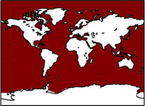
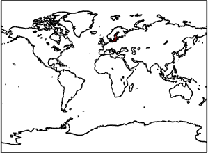
| 1 | GO | Global Ocean | [-180 180] / [-78 90] |
 |
netcdf |
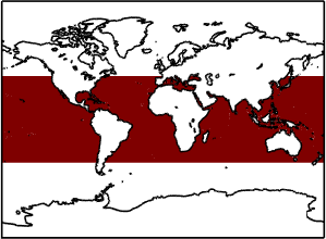
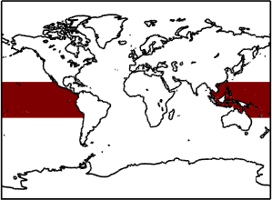
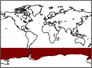
| 2 | MLL-45 | Mid-Low Latitudes 45N-45S | [-180 180] / [-45 45] |
 |
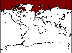
netcdf |
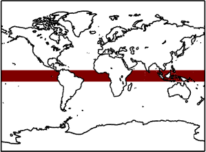
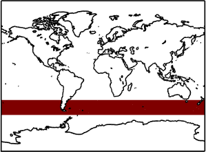
| 3 | EO-10 | Equatorial Ocean 10N-10S | [-180 180] / [-10 10] |
 |
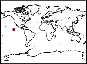
netcdf |
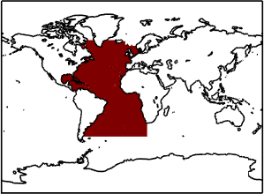
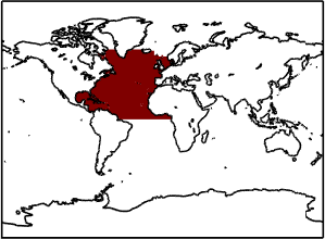
| 4 | AO | Atlantic Ocean | [-98 20] / [-50 66] |
 |
netcdf |
| 5 | NAO | North Atlantic Ocean | [-98 12] / [0 66] |
 |
netcdf |
| 6 | SAO | South Atlantic Ocean | [-68 20] / [-20 0] |
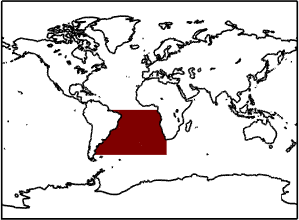 |
netcdf |
| 7 | TAO | Tropical Atlantic Ocean | [-98 14] / [-23 23] |
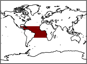 |
netcdf |
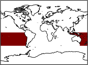
| 8 | PO | Pacific Ocean | [-180 180] / [-50 66] |
 |
netcdf |
| 9 | NPO | North Pacific Ocean | [-180 180] / [0 66] |
 |
netcdf |
| 10 | SPO | South Pacific Ocean | [-180 180] / [-50 0] |
 |
netcdf |
| 11 | TPO | Tropical Pacific Ocean | [-180 180] / [-23 23] |
 |
netcdf |
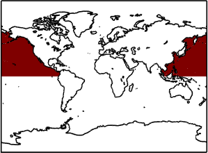
| 12 | IO | Indian Ocean | [20 147] / [-50 27] |
 |
netcdf |
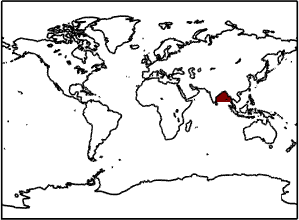
| 13 | BoB | Bay of Bengal | [79 98] / [9 22] |
 |
netcdf |
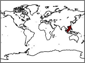
| 14 | SCS | South China Sea | [102 122] / [-3 25] |
 |
netcdf |
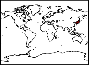
| 15 | SoJ | Sea of Japan | [128 142] / [34 53] |
 |
netcdf |
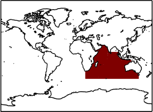
| 16 | SO | Southern Ocean | [-180 180] / [-78 -50] |
 |
netcdf |
| 17 | ARCO | Arctic Ocean | [-180 180] / [61 90] |
 |
netcdf |
| 18 | BS | Baltic Sea | [10 29] / [54 66] |
 |
netcdf |
| 19 | MS | Mediterranean Sea | [-5 36] / [30 46] |
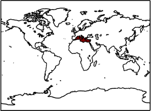 |
netcdf |
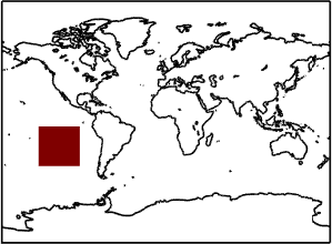
| 20 | SPURS1 | SPURS 1 | [-45 -30] / [15 30] |
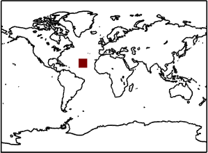 |
netcdf |
| 21 | SPURS2 | SPURS 2 | [-130 -120] / [5 15] |
 |
netcdf |
| 22 | SMOS-C-800-60 | SMOS coastal zone (<800km) 60N-60S | [-180 180] / [-60 60] |
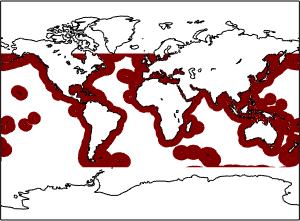 |
netcdf |
| 23 | OTT | OTT zone | [-140 -95] / [-45 -5] |
 |
netcdf |
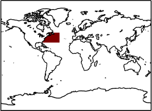
| 24 | GoM | Gulf of Mexico | [-98 -81] / [18 30] |
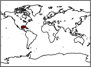 |
netcdf |
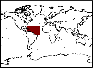
| 25 | AORP | Amazon & Orinoco river plumes | [-78 -25] / [-5 30] |
 |
netcdf |
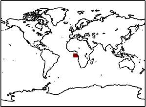
| 26 | CRP | Congo river plume | [0 13] / [-10 0] |
 |
netcdf |
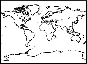
| 27 | MRP | Mississippi river plume | [-98 -81] / [24 31] |
 |
netcdf |
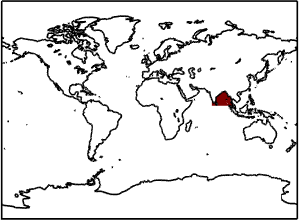
| 28 | GBRP | Ganga & Brahmaputra river plumes | [75 100] / [5 22] |
 |
netcdf |
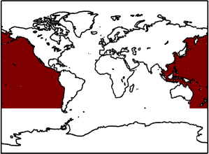
| 29 | RFFF | Roaring forties/Furious Fifties | [-180 180] / [-60 -40] |
 |
netcdf |
| 30 | GS | Gulf Stream | [-80 -40] / [30 50] |
 |
netcdf |
| Case Studies | |||||
| 31 | AORP | Amazon & Orinoco river plumes | [-78 -25] / [-5 30] |
|
netcdf |
| 32 | CRP | Congo river plume | [0 13] / [-10 0] |
|
netcdf |
| 33 | MRP | Mississippi river plume | [-98 -81] / [24 31] |
|
netcdf |
| 34 | GBRP | Ganga & Brahmaputra river plumes | [75 100] / [5 22] |
|
netcdf |
| 35 | RFFF | Roaring forties/Furious Fifties | [-180 180] / [-60 -40] |
|
netcdf |
| 36 | GS | Gulf Stream | [-80 -40] / [30 50] |
|
netcdf |