SSS, SST & currents
Animated gif of the time-evolution of satellite SSS (CCI-L4-ESA-MERGED-OI-V1.8-30DAY-RUNNING) and AVHRR SST in the Gulf Stream region. The SSS and SST fields are superimposed with currents (Globcurrent products):
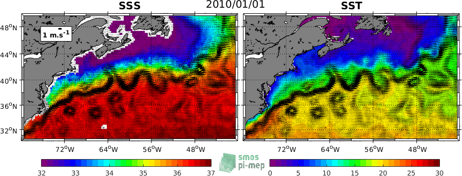
The same animated gif file at higher resolution (1197x433) can be downloaded here
The coherency between the different satellite SSS products and currents from altimetry (Globcurrent products) in the Gulf stream region can also be monitored using the syntool visualisation software available here